RSGS
Bacara Provides Large Defense Contractor with Actionable Data the Same Day
When one of the country’s largest defense contractors needed better data, Bacara not only delivered but put actionable data in the company’s hands the same day it was captured.
Rafael Systems Global Sustainment (RSGS), located in Bethesda, Md., is a small start-up non-traditional American subsidiary of Rafael Advanced Defense Systems and Rafael U.S.A., leaders in defense, cyber, and security solutions for air, land, sea, and space. RSGS was invited to Fort Benning, Ga. to showcase its FIRE WEAVER™ program to the Army. FIRE WEAVER is a revolutionary networked sensor-to-shooter system that enables unequaled speed, accuracy, and safety for tactical forces. FIRE WEAVER manages the entire sensor-to-shooter process, neutralizing multiple targets in a remarkably short time.
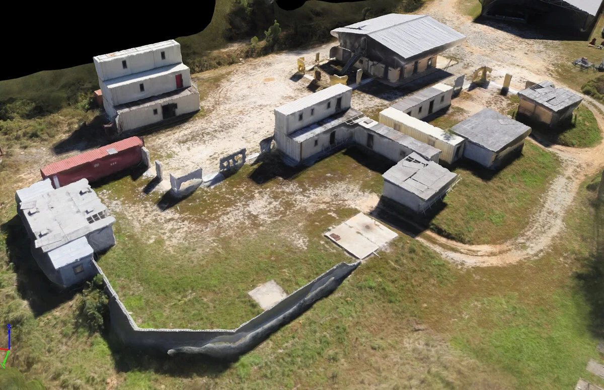
The simulation required a 3D map of the terrain but RSGS also needed a better data source that its hardware could easily ingest - without delays. The company hired Bacara to create a 3D model of the urban training environment and map out the entire area with surveys.
RSGS said the work Bacara did helped the company’s simulation in two major ways:
• Communication. Data provided allowed the positions on the FIRE WEAVER system to seamlessly communicate with each other.
• Efficiency. Data provided saved planning time on the ground as the company didn’t have to quickly figure different elevations.
“It would not have happened had we not the 3D model from Bacara. Having that was fantastic.”
Not only was the data provided invaluable, but Bacara also delivered on their promise quickly, streamlining the capture to product process. Bacara was able to gather data with a drone in about half a day and RSGS had it on their computer that night.
Services We Provided
• 3D Mapping
• Streamlined Process
• Fast Capture to Product
Bacara is one of a handful of elite operators that uses LiDAR technology daily to survey areas. Our team is made up of survey techs who are experienced in collecting topographical survey data including:
• Terrestrial (boots on the ground with a survey crew)
• Fixed-wing drone (for photogrammetry)
• LiDAR drone (for optimal precision and accuracy even in heavily forested areas).
Call Bacara today to find out how our team of professional civil engineers, licensed land surveyors, and certified drone pilots can help drastically improve your land, construction, mining, and infrastructure surveys.

