Our Expertise
Our Expertise
When you want the best results, you work with the best people. And the best people will have the education, experience, and authority to provide high-quality, accurate, and precise information. That’s Bacara.
We are licensed surveyors, engineers, and FAA Part 107 remote pilots, which means we can legally and professionally operate UAVs. Nobody else in Siouxland can say that and it makes a difference.
In some states, you can’t call a UAV flight a survey unless you have a licensed surveyor on staff. Most drone service providers will give you the raw data, but not a plan. Because we are licensed surveyors, our team can interpret and package that data into a useful format for your needs.
From topographical maps, to 3D models, Bacara can do it all.
Download Our Printables
Our Credentials
Part 107 FAA Remote Certified Pilot in Command, is a required certification to fly a UAV for commercial purposes.
Licensed Professional Engineer(s) on staff. Professional engineers must meet a combination of requirements in education, knowledge sets, credentials, and verifiable work. This licensure ensures a standard of competency and accuracy, critical to your project’s successful outcome.
Licensed Land Surveyor(s) on staff, which go through the same rigorous standards as Professional Engineers.
On Staff Autodesk Certified Professional: Civil 3D for Infrastructure Design
Our work in agriculture drainage mapping has been featured in industry magazines and also in peer reviewed research journals.
It is challenging and a significant career commitment to become a licensed surveyor. They are becoming harder and harder to find and finding one that uses UAVs is just icing on the cake. It’s a very exclusive club, and we are proud to have several of these competent individuals on our team.
Technology You Can’t Live Without
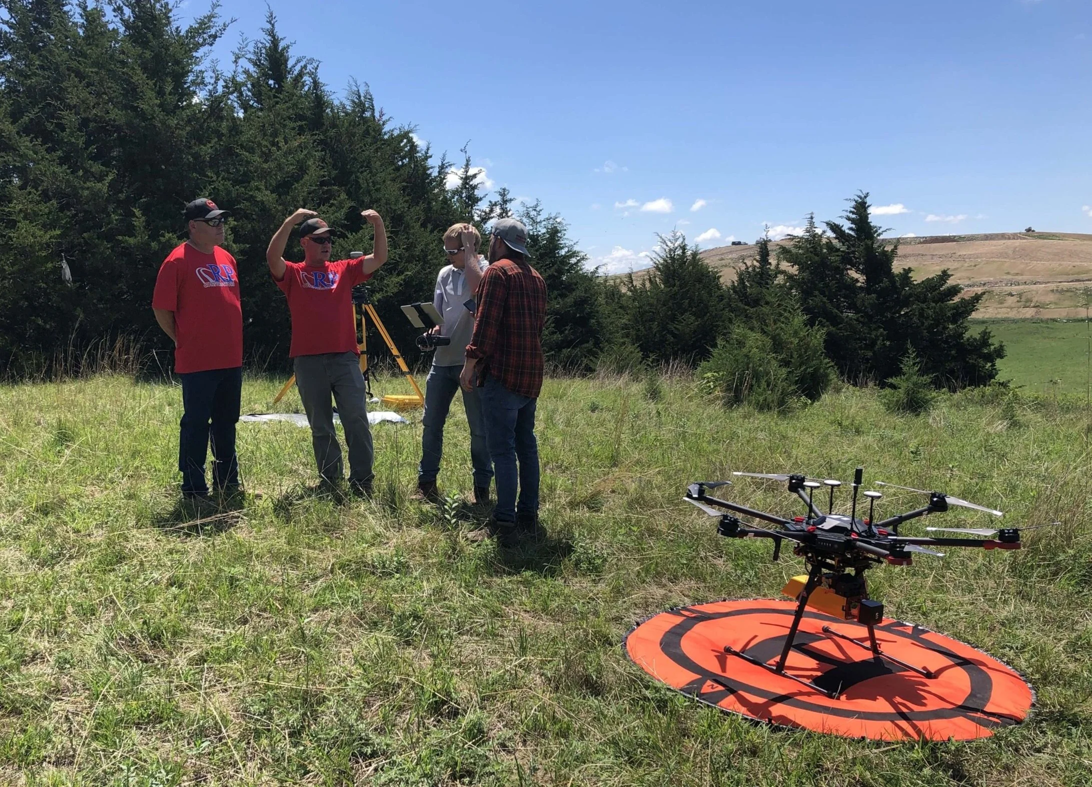
We have two drones to capture whatever data you need. Our fixed-wing drone can take 20 shots per square foot, so it’s infinitely more precise than traditional land surveying methods that take one shot every 25 feet. We also have a UAV mounted LiDAR system (Unmanned Aerial Vehicle with Light Detection and Ranging) with a VX20+ sensor that uses laser pulses to see between obstructions like trees and powerlines to get an accurate view of the ground.
It’s a faster and safer way to get the information you need without putting your crew at risk.
The drones are cool, but the data they collect is even cooler. That is why we built our own powerful computers - to handle the massive amounts of data we capture during UAV flights. The best part is that we keep all the data processing in-house with our data technicians. We will not send your data to anyone else unless you ask us to.
When we see a problem, we find a solution. Even if that means building our own computers. We just won’t accept the idea of “it can’t be done”.
Instead of listing all the reasons something won’t work, we find the one way that it will.
Who We Work With
Government
Agriculture
Civil Infrastructure

Why Should You Work With Us?
When you want something done right, you can count on us to deliver. Speed, quality, precision, and accuracy with every job we complete is our top priority. When you work with us, you might find that we have the answers you didn’t even know you needed. That is why we are the best at providing high-quality and accurate land survey data that takes the stress off of you.
We do it all using brand new, cutting-edge devices and technology, which allows us to survey faster and where others can’t. The accuracy, precision, and speed are unmatched. Our UAV LiDAR - with a VX-20+ sensor is the shiniest new toy in the country.
What sets us apart from the competition is that we take the data and figure out how to use it to your advantage and in ways you maybe hadn’t thought of yet. We don’t just hand you a pile of data points. We gather and interpret it into something you can take action on.
When you want something done right, you can count on us to deliver.
“I want to solve problems for people who didn’t know they had a problem.”
– Ryan Callaghan
President/Member
“Data is useless unless you can turn it into a solution.”
– Adam Batschelet
Director of Operations and FAA Part 107 Certified Remote Pilot in Command