FAQs
Which type of survey do I need?
Terrestrial – This is the traditional method, done on foot with a survey crew. It’s the ideal choice for when you need to have the property dug up before it can be shot, or if construction staking is needed.
RTK fixed-wing mapping drone – This is an excellent option for large, open areas without many visual obstructions of the ground. With this drone we use photogrammetry to stitch the hundreds and sometimes thousands of individual, RTK corrected photos from the drone together to create a high-resolution aerial image. From this process we also get extremely accurate topography data.
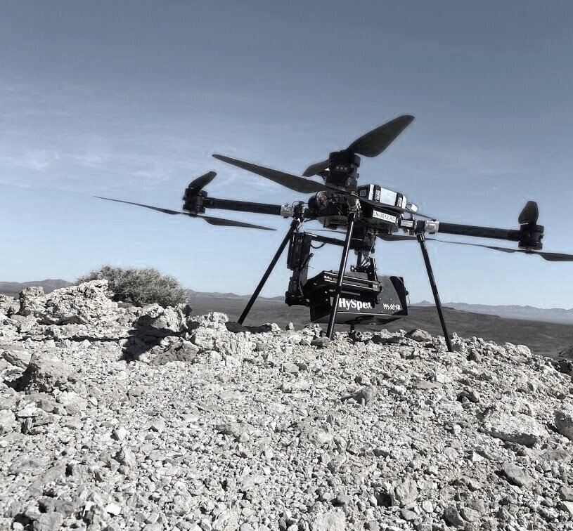
UAV LiDAR - Often flown at the same time as the fixed-wing, this LiDAR sensor uses active data collection to see between obstructions such as power lines and trees. It is essentially the Cadillac of UAV survey and mapping technology, and very few firms in the United States are able to say that they can offer UAV LiDAR services along with licensed land surveyors and professional engineers to oversee the data collection and the final delivered product.
What is active vs passive data collection?
Passive data collection is like using your eyes. You’re able to see the tops of objects, but not the ground beneath it. Our fixed-wing drones are able to capture geographical data based on the highest point of objects below, from a tree, to a building or even a blade of grass. This type of surveying is perfect for flat roads and surfaces. If your AOI (area of interest) is more complex, active data collection with our LiDAR drone is the way to go. (LiDAR stands for Light Detection and Ranging).
Active data collection is like a laser beam. If light can go there, our VX-20+ LiDAR scanner can collect that data. The result is an accurate and precise 3-D point cloud of geographical data without vegetation or man-made obstructions. This type of surveying is ideal for areas with dense brush or complex terrain.
How do I get started?
Tell us about your project and we’ll help to determine the best surveying method.
We will capture data using our fixed-wing or LiDAR drone.
The data collected will be processed, interpreted, packaged, and if needed, developed into a plan, as a deliverable.
What happens to my survey data?
We deliver data in three ways:
High-resolution ortho photo (RTK GPS corrected, accurate aerial photo).
Digital elevation/surface model (topography of the ground) from LiDAR scan.
Survey Grade High Resolution Point Cloud with obstructions removed.
How long will it take to get my data back?
Timelines on your data delivery have several factors, from the type and size of the area surveyed, to your project urgency. Our turnaround time from the start of data collection to the final deliverable is typically a week or less.
More complex and larger projects will take additional time, but we can process and deliver the results in a fraction of the time of traditional surveying.
Contact us to learn more.
What if I already have some data?
There’s no such thing as too much data. Trust us, engineers love it. We can work with your existing surveys and topographical mapping and in many cases incorporate it into what we capture with our drones if it is beneficial to the final product.
What if I don’t know what I need?
Bacara is a full-service engineering and surveying company.
Contact us to learn more about how we can help.
How accurate is this?
Accuracy is the degree to which the data conforms to the actual land features.
Our drone surveying methods are within 1/10 foot accurate making it even more exact than traditional terrestrial surveying.
How precise is this?
Precision is how many total measurements were taken within a given area. This type of surveying is infinitely more precise than traditional methods because of the number of measurements we can take.
Our drones measure pitch, yaw, and roll of the scanner in flight to know exactly where it’s at in space, and combined with GNSS corrections, a resulting a 3-D point cloud with 100 points per square meter is created.
Have more questions?
Get in touch today to discuss your project.