Superior Visibility, Stronger Decisions
Powerful Drone Photogrammetric and LiDAR Mapping Technology, Captured and Interpreted by Licensed Professionals and Experts
Bacara; A Service-Disabled Veteran-Owned Small Business and certified Targeted Small Business with the Iowa Economic Development Authority


The Problem We Solve
Running a business or tackling a project requires you to make numerous critical decisions. We help you make some of those decisions easier, faster, and with the bottom line in mind.
Imagine being able to revolutionize your business with high-quality surface and 3D data delivered to you quickly with unsurpassed accuracy and precision. Now that is a competitive advantage that you do not want to miss.
Traditional land/topographic surveying methods can be time-intensive and often have limitations and restraints. With Bacara, you can get more data interpreted for you at a fraction of traditional terrestrial surveying time and cost.
When you want speed, quality, precision, and accuracy in your project, you hire Bacara.
Our Technology
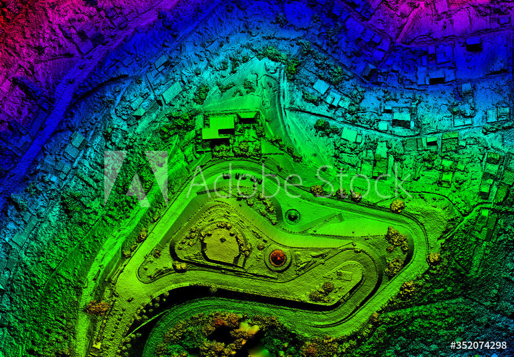
By working with Bacara, you can access premium technologies including our state of the art LiDAR equipped drone. Bacara’s YellowScan VX-20+ is one of the newest and most accurate survey grade LiDAR scanners available on the market today.
We can complete your survey faster and more accurately than traditional terrestrial methods. We have a team of licensed engineering and surveying professionals in-house to interpret your data and turn it into something useful.
Download our Printables
Bacara also gives you the peace of mind that comes from knowing all your data is secure, as all of your data is processed and hosted on our servers. And if you need engineering or construction services, we can help with that too, through our sister companies CEC and RP Constructors.
Look Under the Hood

The most accurate piece of technology on the market, and infinitely more precise than anything before it.
OUR TECHNOLOGY
20
shots per
square foot
TRADITIONAL METHODS
1
shot every
25 feet
High-quality data interpreted in a fraction of the time.
Our 3-step Process

Onsite Review & Fly

Upload & Process

Analyze, Plan & Deliver
Contact us.
Working with Bacara means you get high-quality data, interpreted for you, in a fraction of the time. By partnering with us, you get access to the two best technologies in the UAV surveying world: highly accurate photogrammetry and LiDAR. Together, these tools are the best of the best. You also receive a FAA certified UAV pilot to fly it over your AOI and licensed land surveyors to interpret the data, turn that data into usable information and work together with you towards a solution.
Iowa TSB
Bacara is a certified Targeted Small Business with the Iowa Economic Development Authority.

What It Means to Be a
A Service-Disabled
Veteran-Owned Business
Being part of America’s Heartland is a considerable part of our identity as a small business. We are proud to be majority-owned by an American veteran and to recognize all servicemen and women. This exclusivity is how we’ve gained experience in the military and government industry. It is an honor to have retired Major General Allen Batschelet as a principal, founder, senior business advisor, and business development director. His extensive and distinguished military career, leadership, and guidance have been instrumental in how Bacara operates and leads.